Welcome to the “Maps” section of this website.
|
COPYRIGHT NOTICE The maps on this page marked ‘© Fred Williams, 2026’ beneath them are my own work, and I hold the copyright in them. This statement applies only to those maps. |
 “Select a building to view a video of a 3D Model of it!” – An interactive map © Fred Williams, 2026 This “interactive” map allows users to click on a building outline on the map and display a short video of the 3D Model of the selected building in a pop-up window. The map is best viewed in “Full Screen” mode (button located at the top right of screen). To exit “Full Screen” mode simple press the “Esc” key on the keyboard, “swipe down” on the screen of an Ipad or, if shown, on a big “X” at the top of the screen. |
 “Display many images of JHQ taken from above – An interactive map © Fred Williams, 2026 This “interactive” map displays many images of JHQ taken from above for the book ‘Little Britain Rheindahlen: Erinnerungen an das Joint Headquarters’ by Rudolf Bueschges. Clicking on a marker on the map will display a image taken from above in a pop-up window. |
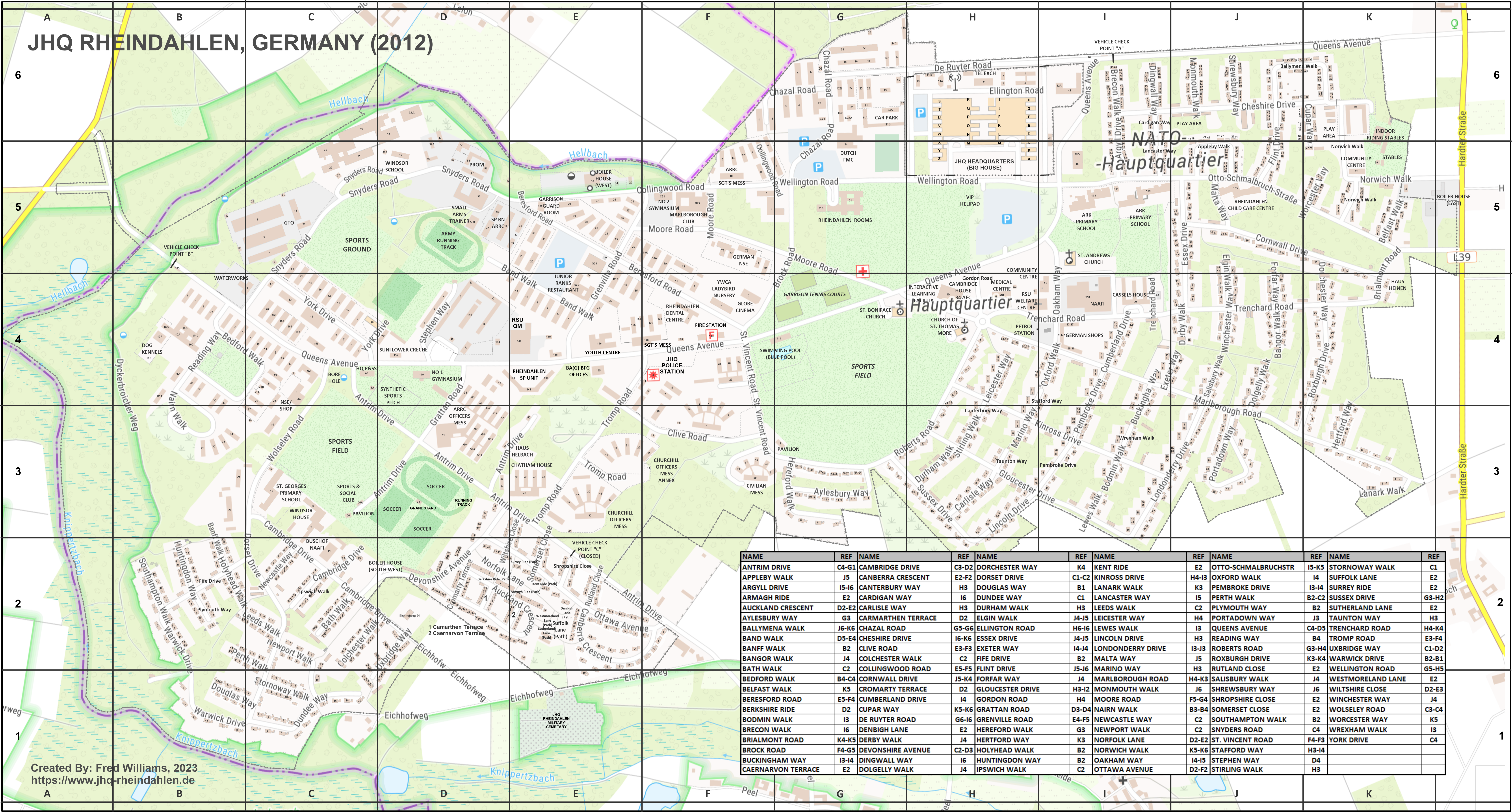 JHQ Rheindahlen Map – 2012 (20MB) + Annotations + Index © Fred Williams, 2026 This high definition “TopPlusOpen” map shows clearly the house numbers so that individual addresses can be found! It also has text descriptions of many locations. Now with all roads and paths and a “Street Index”. |
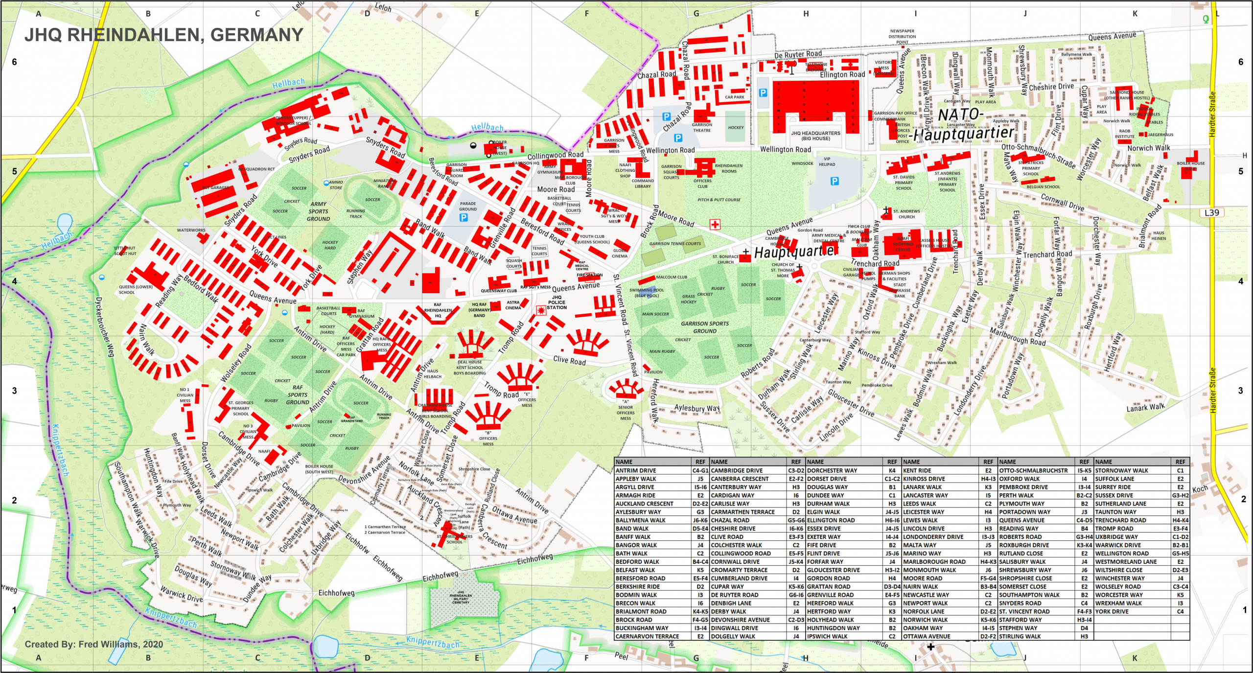 JHQ Rheindahlen Map “Non-Residential Buildings“ – 2012 (20 MB) + Annotations + Index © Fred Williams, 2026 This high definition “TopPlusOpen” map highlights those building that were not “Married Quarters”. |
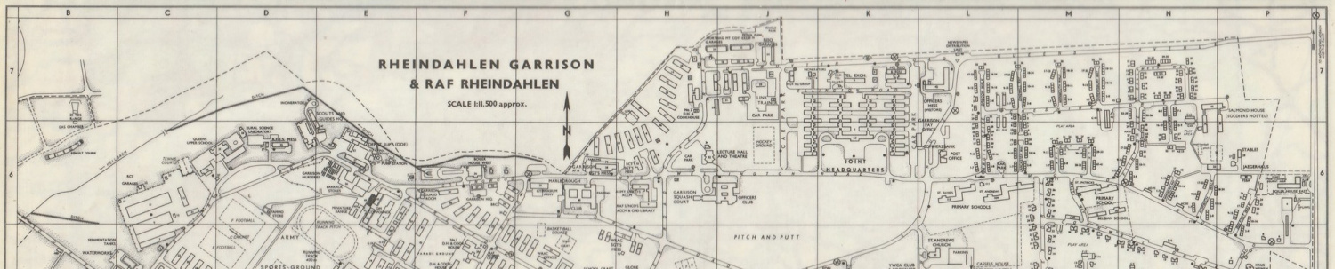
 Garrison Maps Comparison (1954 against 2012) © Fred Williams, 2026 This “Before & After” map is a great way of displaying what changes were made to JHQ over 7 decades! |
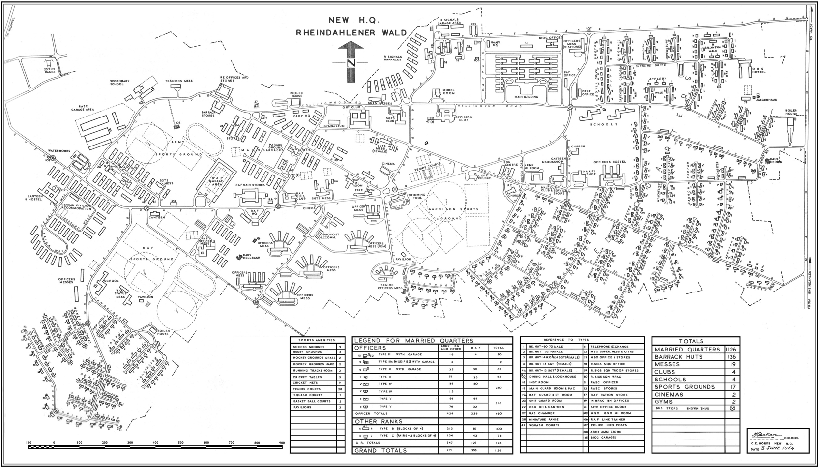
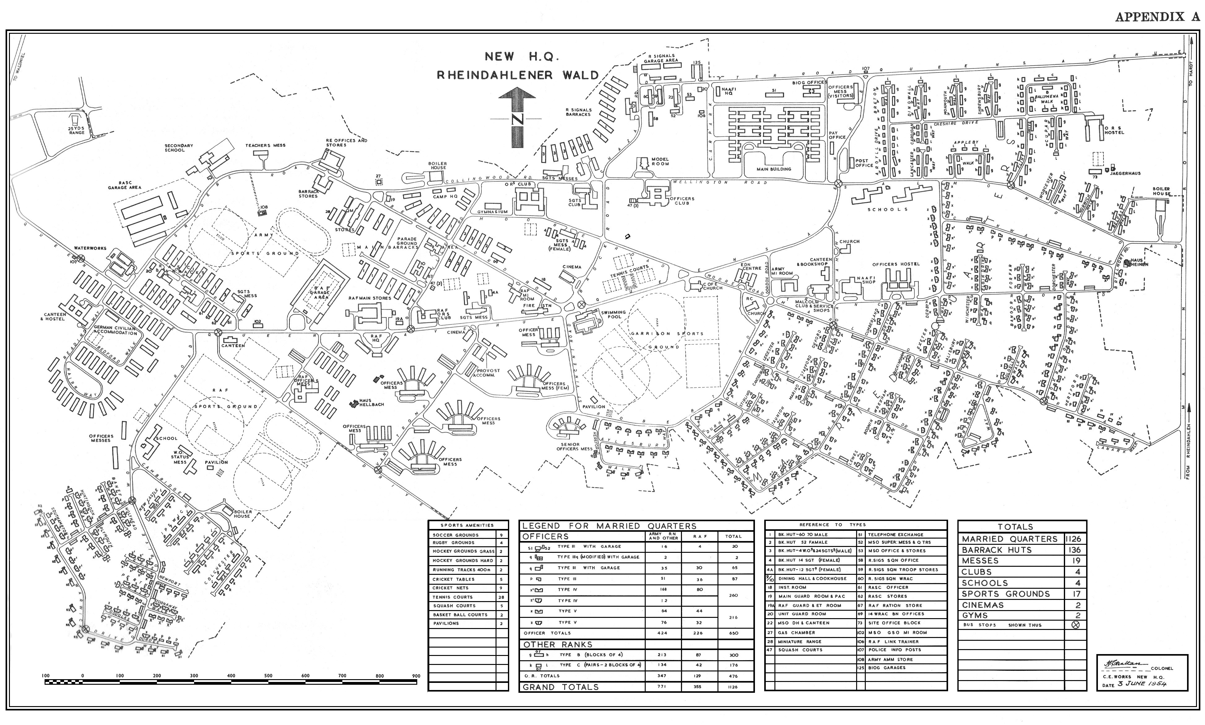 Original JHQ Garrison Map 1954 (1MB) © The Institution of Royal Engineers This map is from the book “New Headquarters in Germany – 1956” by Colonel H. Grattan (C.B.E.). (See the “Documents” section of this website to view the complete book) It has been added to this website with the kind permission of N E Montagu MA CEng MIMechE FInstRE, Editor of the RE Journal, The Institution of Royal Engineers. |
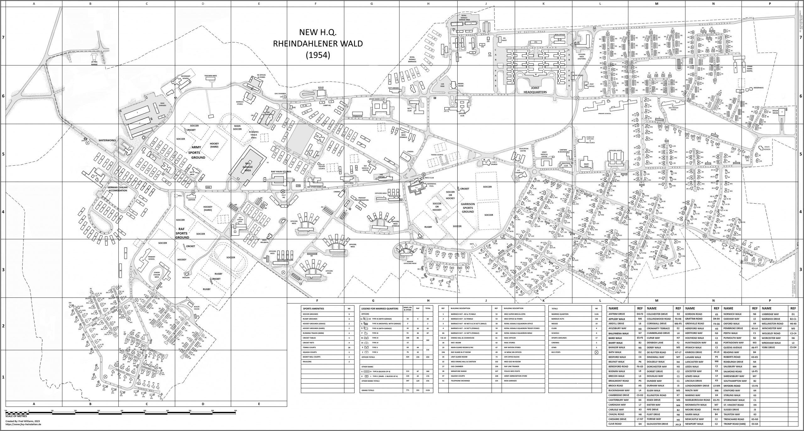 Reformatted JHQ Garrison Map 1954 (1MB) © Fred Williams, 2026 This reformatted map is based on an original map from the book “New Headquarters in Germany – 1956” by Colonel H. Grattan (C.B.E.). (See the “Documents” section of this website to view the complete book) |
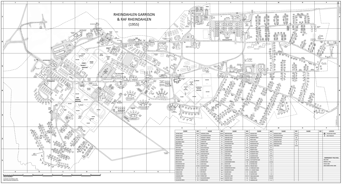 JHQ Garrison Map 1955 (3MB) © Fred Williams, 2026 This map has been created using many images of an almost destroyed original map that was provided by Don Whitehead, and has been digitally stitched back together, remastered and reformatted by Fred Williams. |
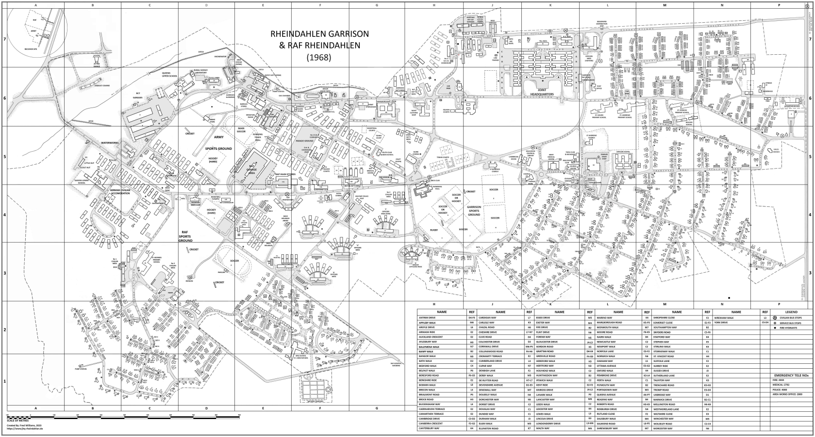 JHQ Garrison Map 1968 (3MB) © Fred Williams, 2026 This map has been created using an image copy of the original map that was provided by Ron Williams, and has been digitally remastered and reformatted by Fred Williams. |
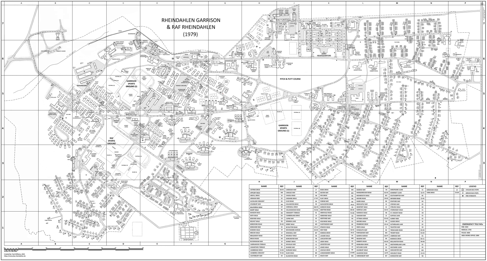 JHQ Garrison Map 1979 (3MB) © Fred Williams, 2026 This map has been created using an image copy of the original map that was provided by Rudolf Bueschges, and has been digitally remastered and reformatted by Fred Williams. |
JHQ Garrison Map 1988 (3MB) © Fred Williams, 2026 This map has been created using an image copy of the original map that was provided by Rudolf Bueschges, and has been digitally remastered and reformatted by Fred Williams. |
JHQ Garrison Map 1994 (3MB) © Fred Williams, 2026 This map has been created using an image copy of the original map that was provided by Rudolf Bueschges, and has been digitally remastered and reformatted by Fred Williams. |
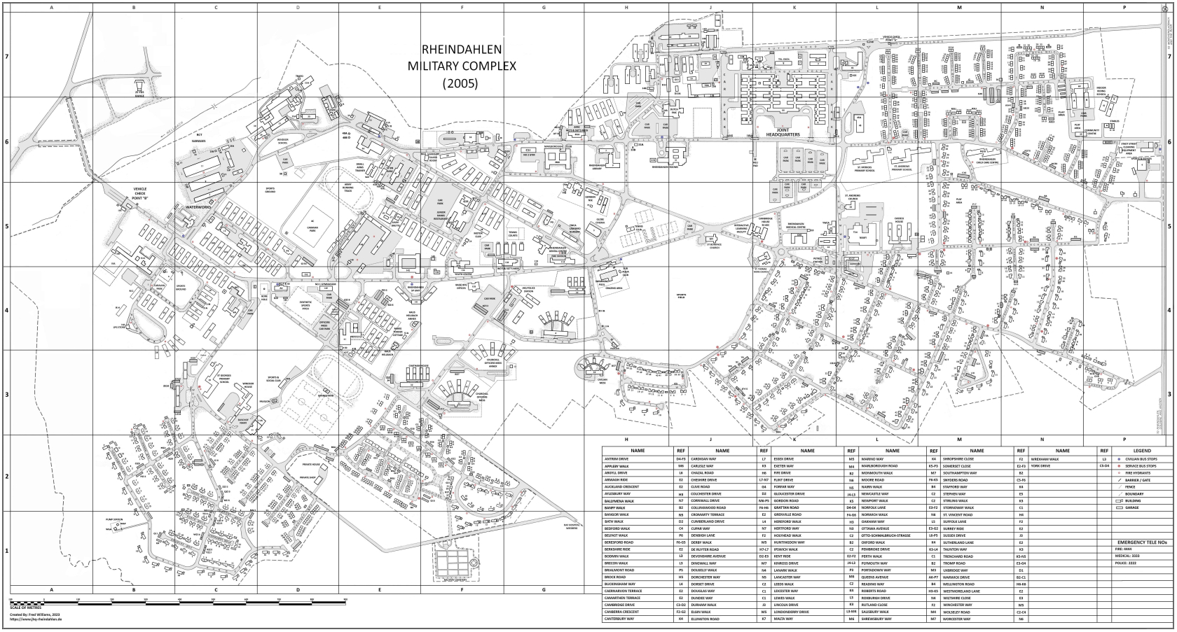 JHQ Garrison Map 2005 (3MB) © Fred Williams, 2026 This map has been created using an image copy of the original map that was provided by Rudolf Bueschges, and has been digitally remastered and reformatted by Fred Williams. |
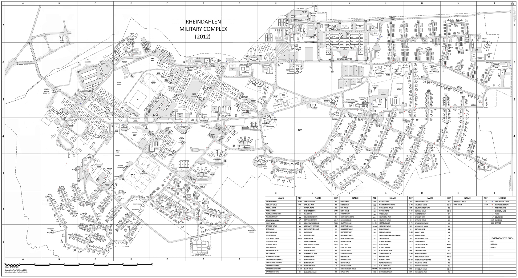 JHQ Garrison Map 2012 (3MB) © Fred Williams, 2026 This map has been created using an image copy of the original map that was provided by Rudolf Bueschges, and has been digitally remastered and reformatted by Fred Williams. |
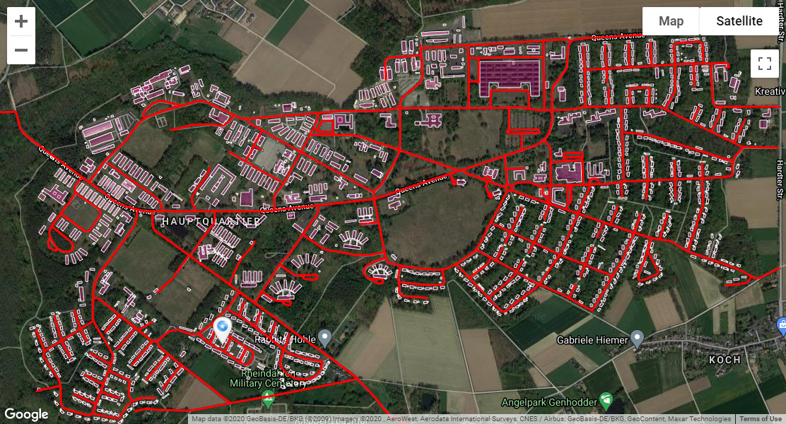 “Select a building to get a description of it!” – An interactive map © Fred Williams, 2026 This “interactive” map allows users to navigate around the current “Google” map of the JHQ area. Clicking on a building outline on the map will display information about the building in a text bubble. |
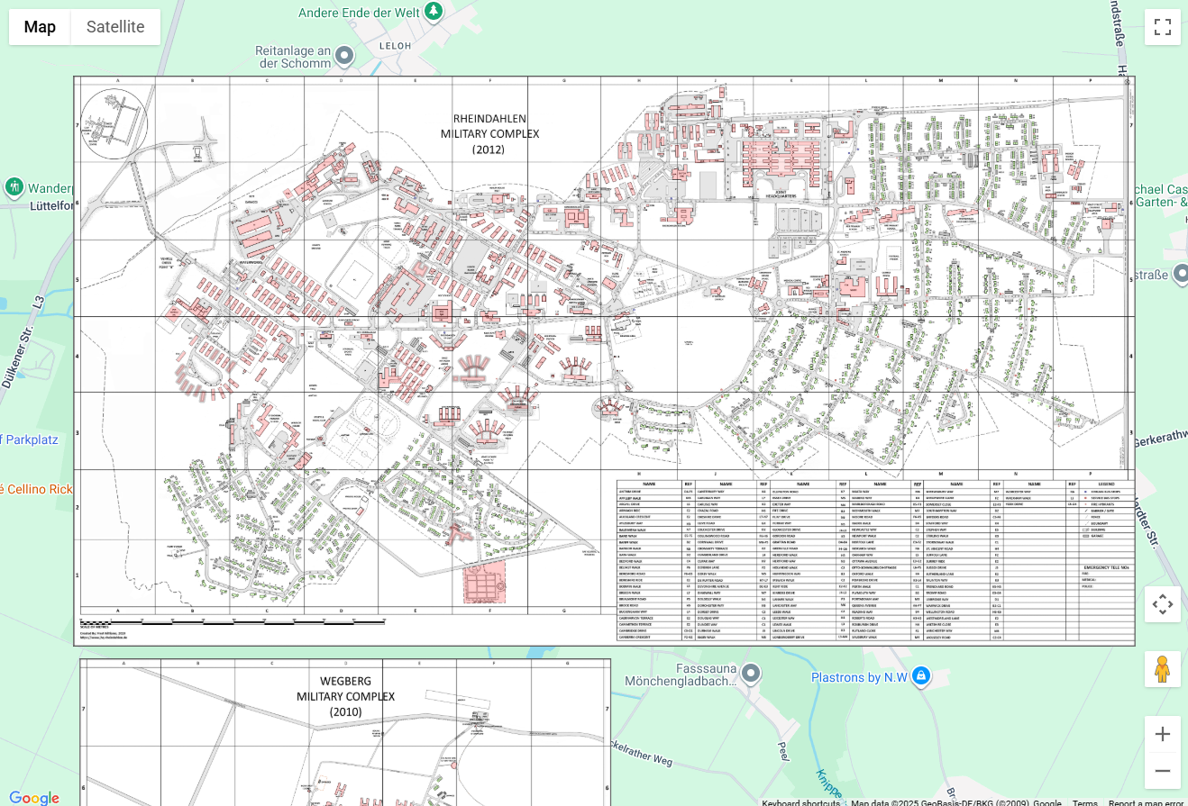
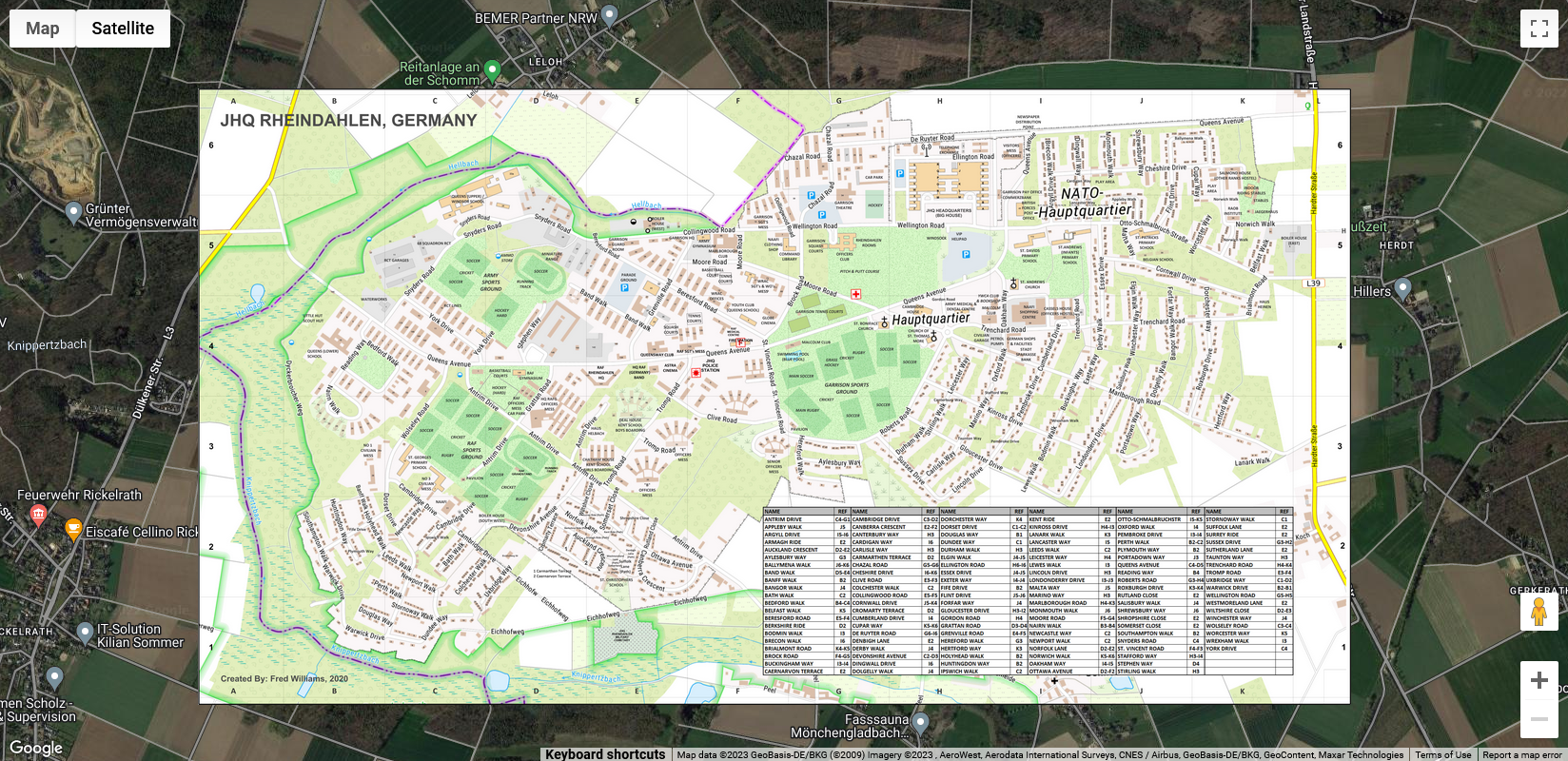 “Google Map with TopPlusOpen Overlay” – An interactive map © Fred Williams, 2026 This “interactive” map allows users to navigate around the current “Google” map of the JHQ area and view a “TopPlusOpen” (German equivalent of UK Ordnance Survey) overlay. |
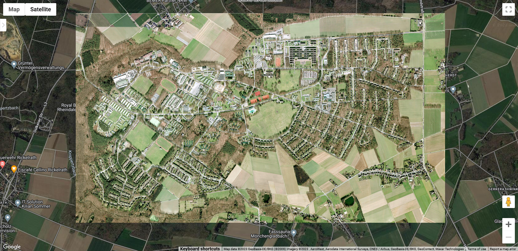 “Google Map with Google 2013 View Overlay” – An interactive map © Fred Williams, 2026 This “interactive” map allows users to navigate around the current “Google” map of the JHQ area and view the “2013 Version of the Google Map” overlay. |
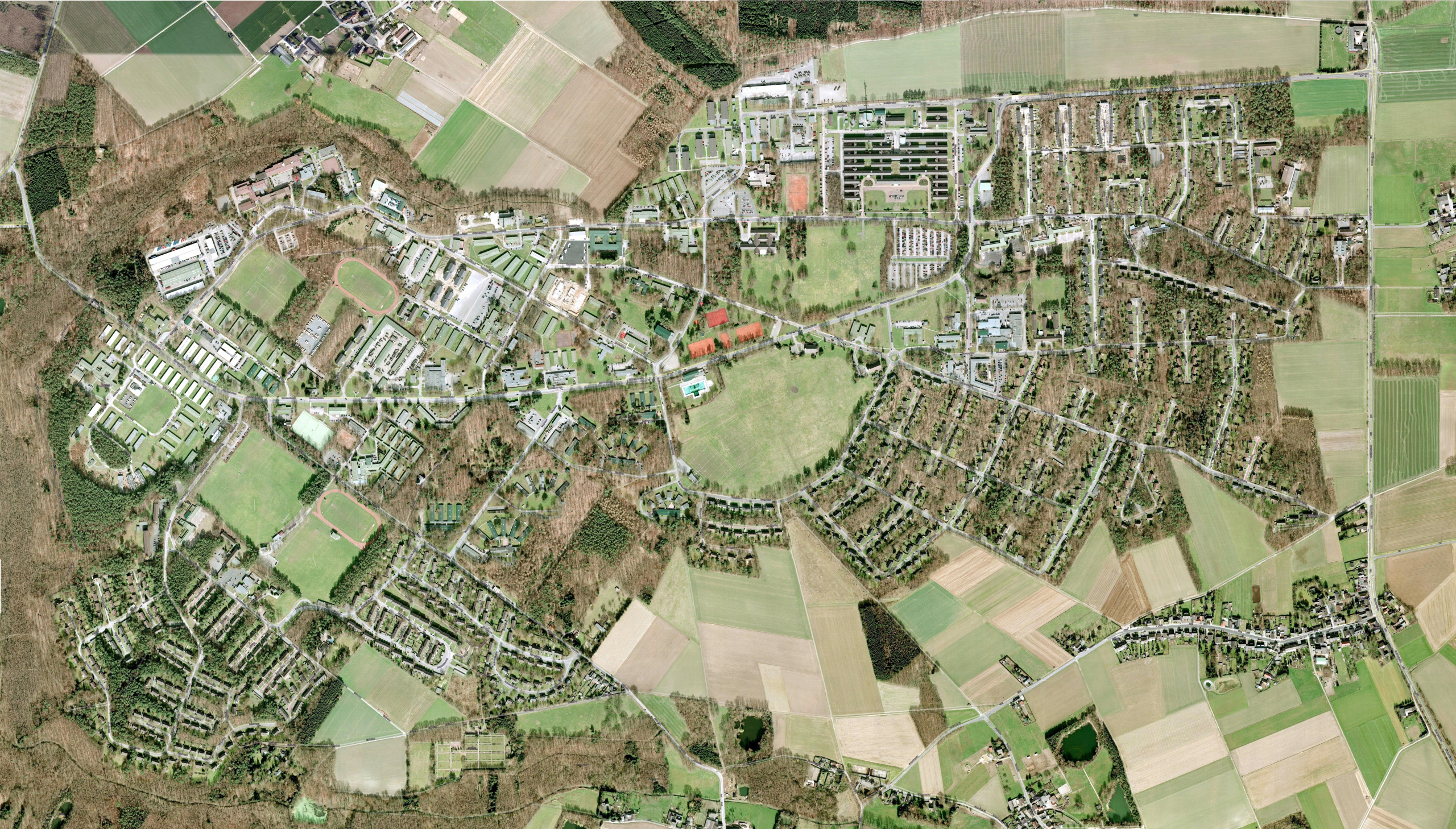 “Google” map of JHQ before closure! (28MB) © Fred Williams, 2026 The map was created using a large number of screenshots taken from Google Maps in the months before the closure of JHQ as the Google map will change over time thus removing all evidence of the existence of JHQ! * Please note: due to the size of this map it may not display on iPad’s etc. |
“Google” map of JHQ before closure + House Outlines + House Numbers! (28MB) © Fred Williams, 2026 The map was created using a large number of screenshots taken from Google Maps. Building outlines and house numbers have been overlaid so that individual addresses can be found! * Please note: due to the size of this map it may not display on iPad’s etc. |
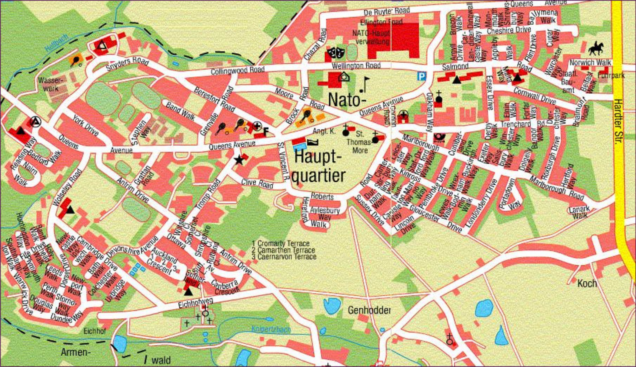 Colourful map of “Nato Hauptquartier” (13MB) A high level “tourist” like map which shows the names of streets. Probably dated around 1970. |
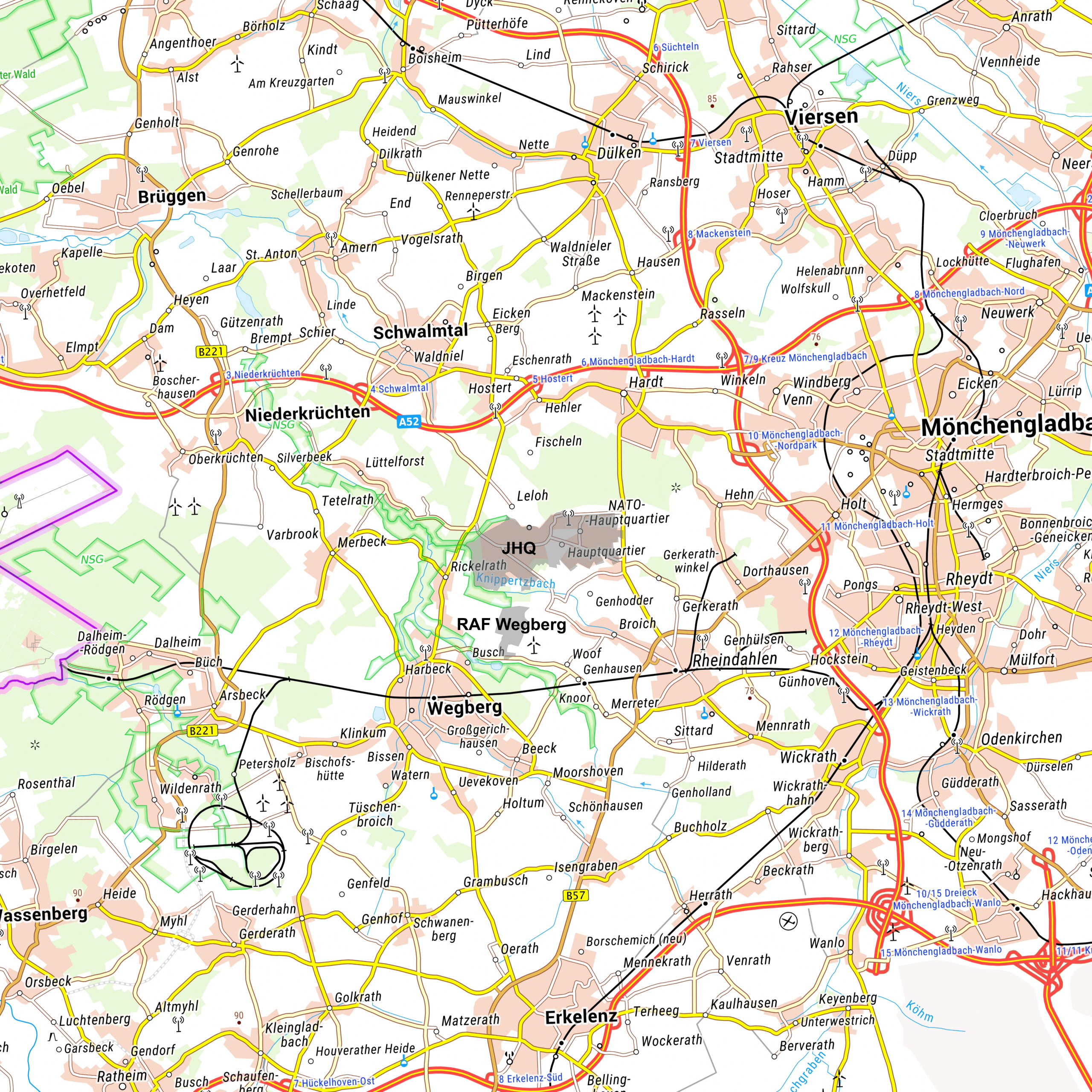 German “TopPlusOpen” map of approaches to JHQ Rheindahlen (37MB) Created by: Fred Williams This map shows the approaches to JHQ Rheindahlen. |
Official 1968 map of “Approaches to Rheindahlen Garrison & RAF Rheindahlen” (2MB) Provided by: Malcolm Bradbury Copy of an official map of the Approaches to Rheindahlen Garrison published in 1968. |
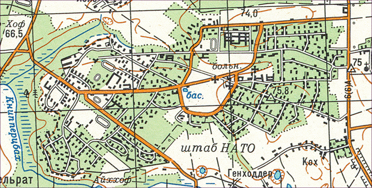 Soviet map of JHQ from 1986 (1MB) Provided by: Simon Moore This Russian map of JHQ dates from 1986. Simon has also contributed several videos on the “Videos” Section. |
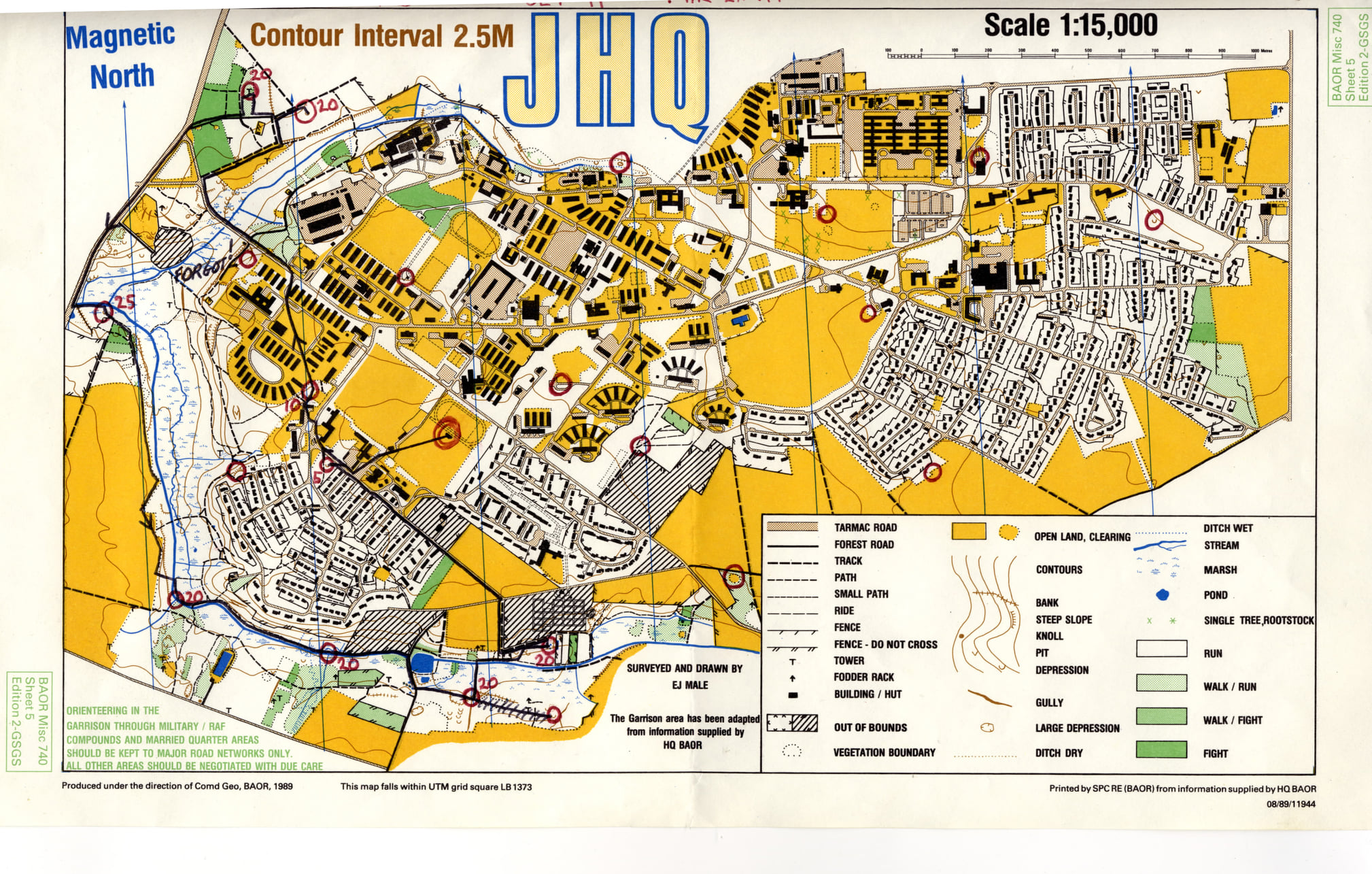 JHQ Orienteering Map (Original) from 1991 (1MB) Provided by: Terry Morton JHQ Orienteering Map from 1991. |
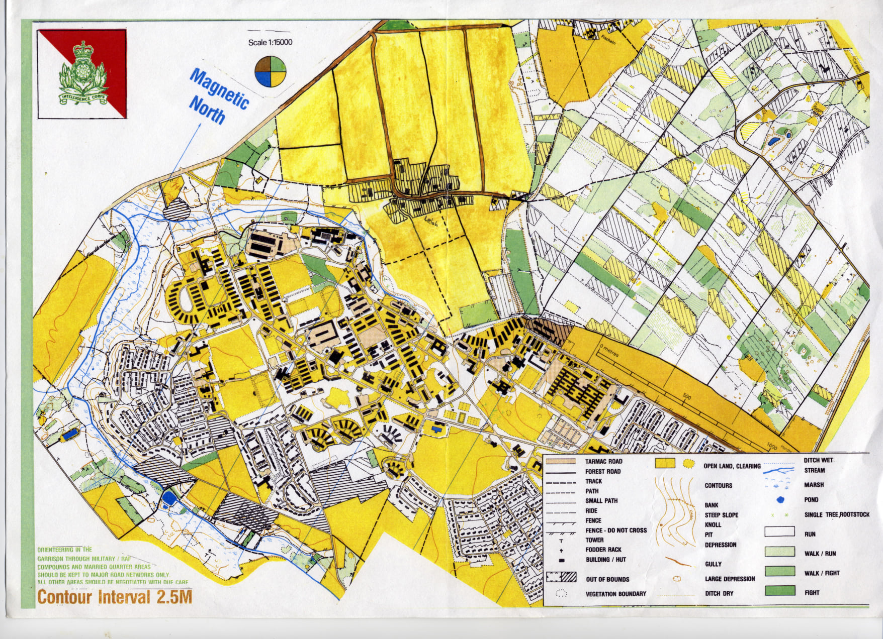 JHQ Orienteering Map (Amended) from 1991 (1MB) Provided by: Terry Morton |
If the copyright holder of any of the above maps objects to their being used on this website then please email webmaster@jhq-rheindahlen.de who will see to it that it is removed.