Welcome to the “landing page” for the “Projekt Luftbilder zum JHQ” referred to in the recently published book, “Little Britain Rheindahlen: Erinnerungen an das Joint Headquarters”
The aim of the “Projekt Luftbilder zum JHQ/ Aerial Photographs of JHQ” was to systematically fly over the entire area of JHQ Rheindahlen to capture as many photos as possible of the landscape, the streets, the living and working areas, and significant individual buildings.
Three flights, in a shoulder-wing aircraft were made in October 2021, February 2022 and March 2025, when the views of the buildings were not obscured by tree foliage, in perfect weather conditions. JHQ was systematically flown over from east to west and repeatedly circled at a height of a few hundred meters to capture as many areas as possible with the sun behind the camera. The RAF Hospital, Wegberg, was also included in the flyovers. The pilot was Prof. Helge Kleinfeld and the photographer, Rudolf Büschges.
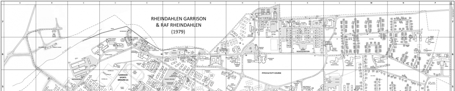
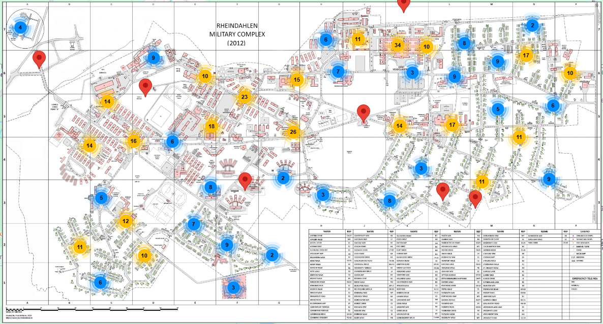
After reviewing all the images, over 500 were selected to be included on the background map, a black and white map of JHQ, dated 2012, and RAF Wegberg, dated 2010. This background map was created by Fred Williams who also created the interactive map to which the photos were linked.
The position of each photo, indicated by a marker on the map, was determined by the intersection point formed by two diagonal lines on the photos.
Updated instructions on how to use the interactive image map.
You can easily zoom in on the map, right down to the house level. Clicking on a house outline displays the address and house number.
Clicking on one of the markers opens an information window with the photo number, category (street/building name), coordinates, description and a small image. Clicking the “X” in the top right corner will close the window.
Clicking on the small photo will open it in the center of the screen in a slightly larger size. Clicking anywhere on the screen outside of this larger image window will then return control to the smaller window which can then be closed by clicking “X” in the top right corner.
Right-clicking on either the smaller or larger photos will present several options, such as “Open in new tab” which will display the photo in a new browser window at full screen size. Other options are “Save Image as”, “Copy Image”, “Copy Image link” and “Magnify Image”.
At the top of the screen there is a dropdown list of categories sorted by “FOOTPATHS”, “INDIVIDUAL BUILDINGS”, “JHQ AREAS”, “NON-RESIDENTIAL STREETS”, “RAF HOSPITAL WEGBERG”, “RESIDENTIAL STREETS” which can be used to filter which photo markers are to be displayed on the map.
The map can be accessed via the following link.