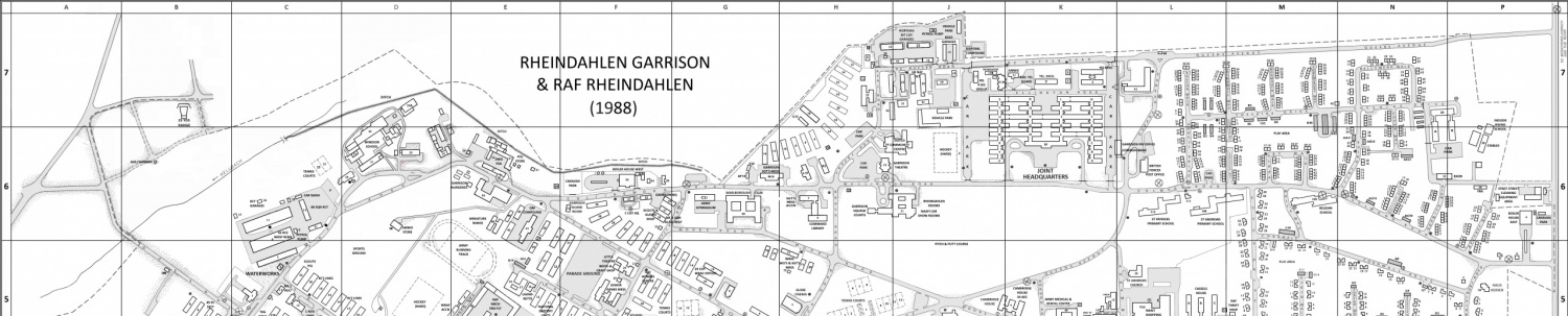
The JHQ, Rheindahlen, Germany, 3D Model is COMPLETE!
After two years work the 3D-Model of JHQ has been completed, showing all of the many buildings present in JHQ when it was closed down in 2013. I have been supported in this huge task by Rudolf Bueschges, author of the book “Gebaeude des Joint Headquarters”, who has provided lots of helpful information.
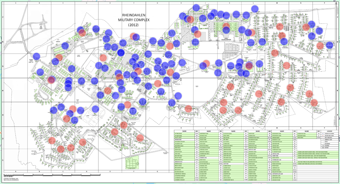
Click on the map image below for access to an Interactive Map that will allow you to view short 3D videos of every building and street on JHQ.
Click on a building outline or street name in the index table to display short 3D videos of the selected building or street. Click on the menu entries in the index table to show 3D aerial views of JHQ. Click on a “Red Circle” to view, at a higher level, a circular video around that point. Finally, click on the “Blue Circle” to view, at a lower altitude, a circular video that shows more detail.
The map is best viewed in “Full Screen” mode (find the ![]() button). To exit “Full Screen” mode press (1) the “Esc” key on your keyboad (2) “swipe down” on the screen of an Ipad (3) if shown, a big “X” at the top of the screen or (4) the reverse of the
button). To exit “Full Screen” mode press (1) the “Esc” key on your keyboad (2) “swipe down” on the screen of an Ipad (3) if shown, a big “X” at the top of the screen or (4) the reverse of the ![]() button.
button.
Author: Fred Williams