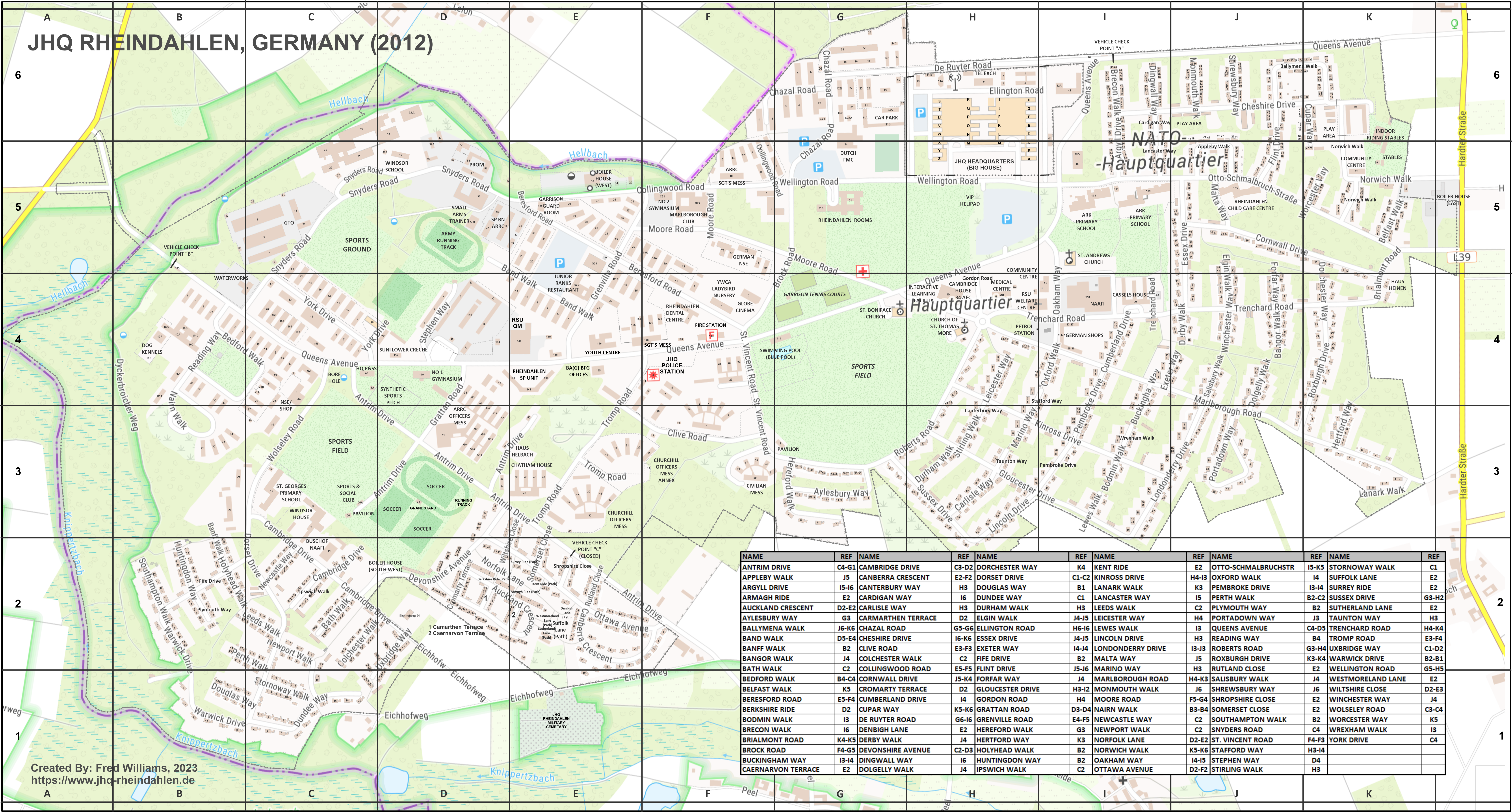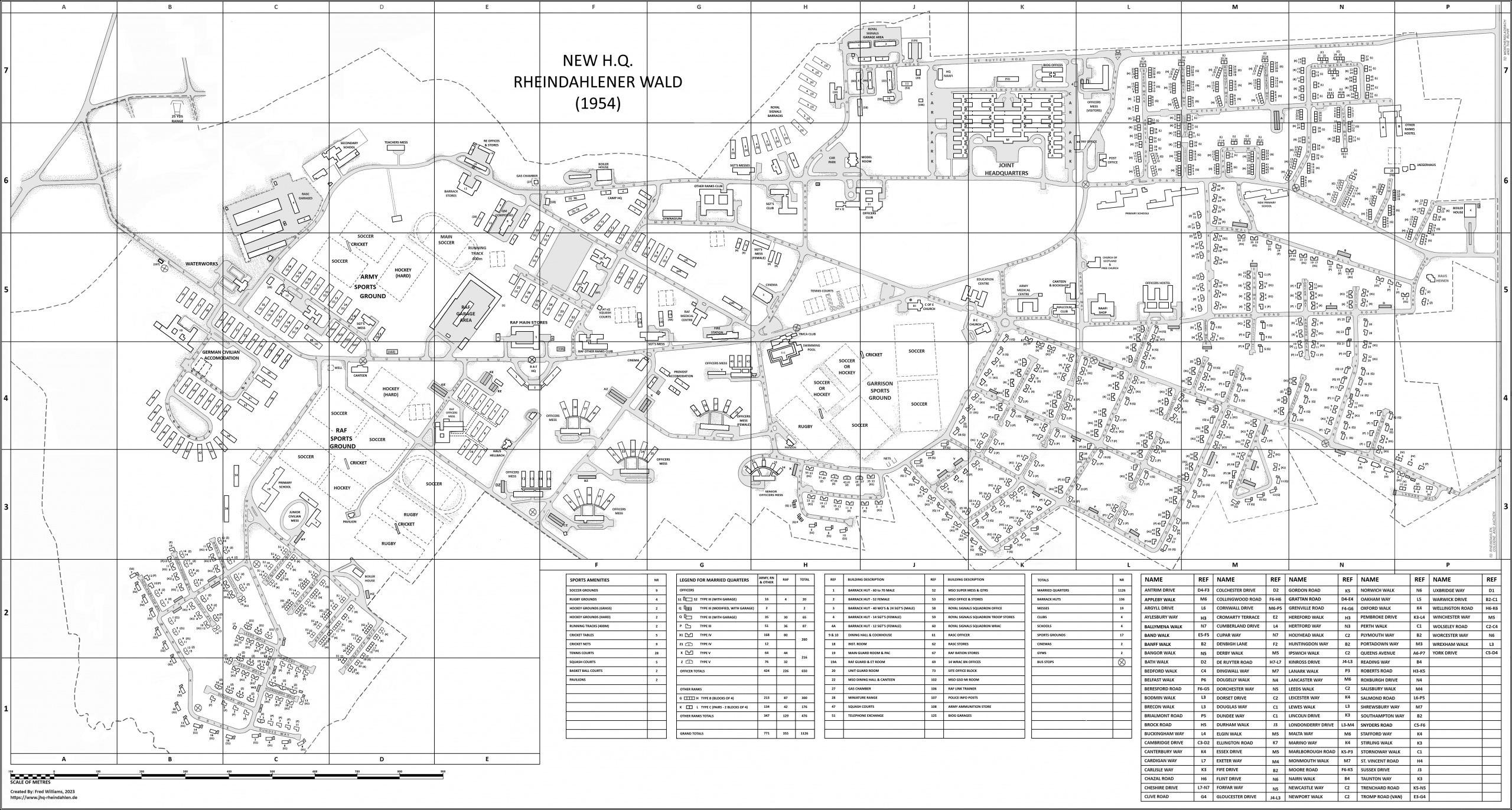
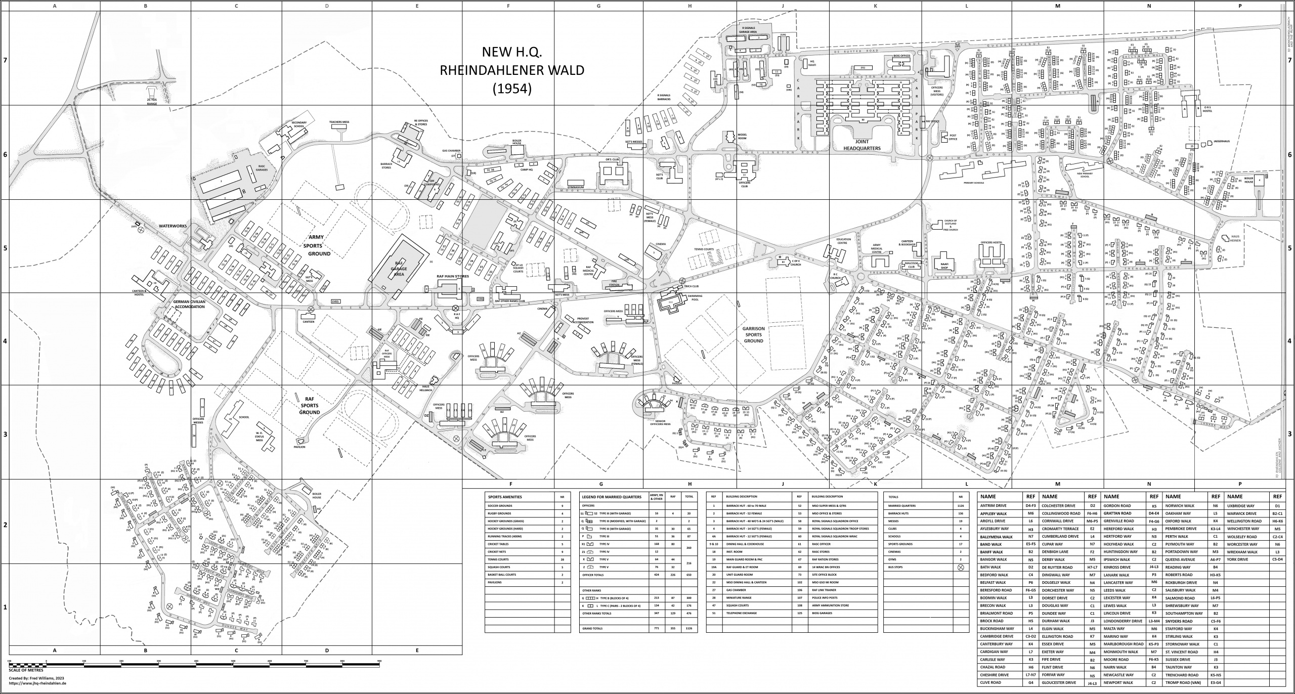
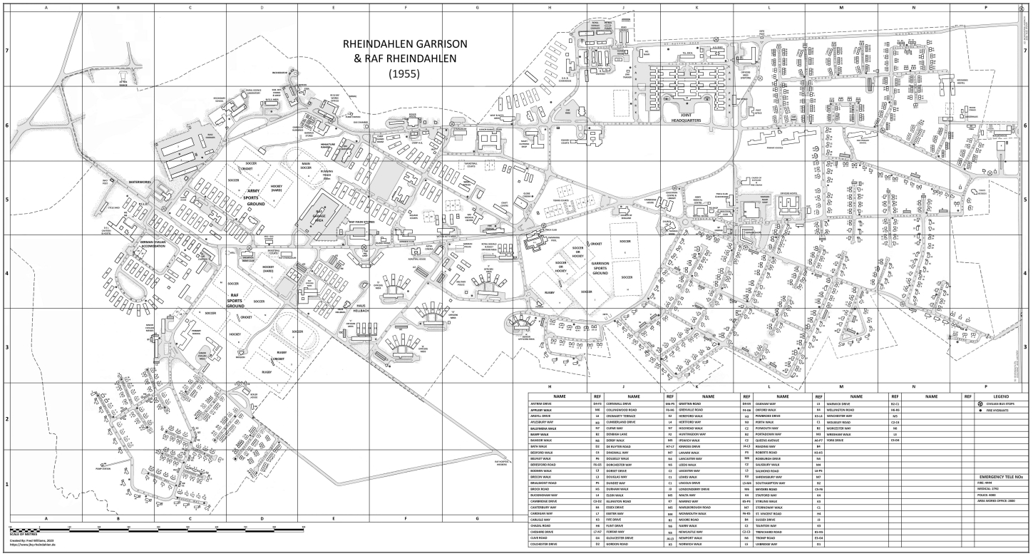
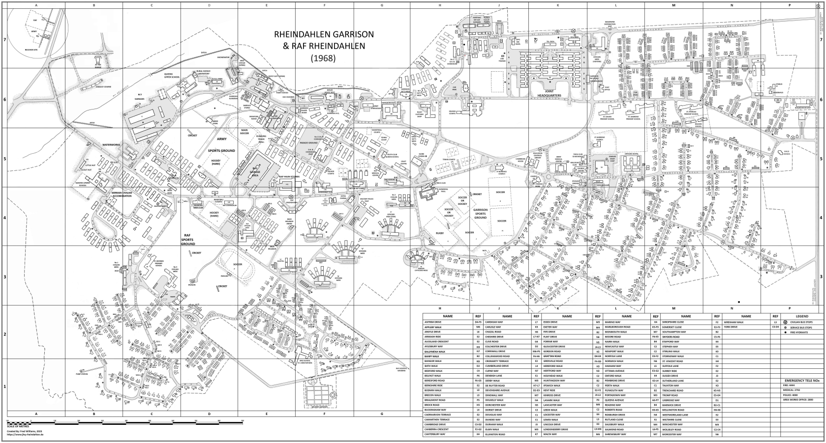
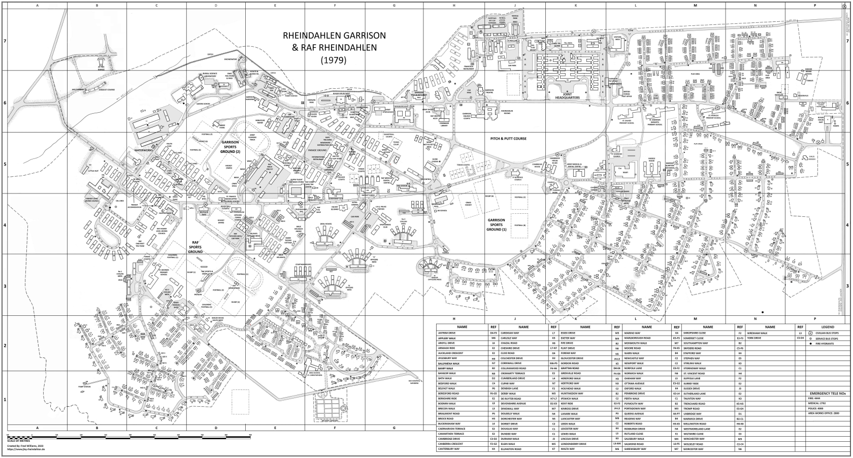
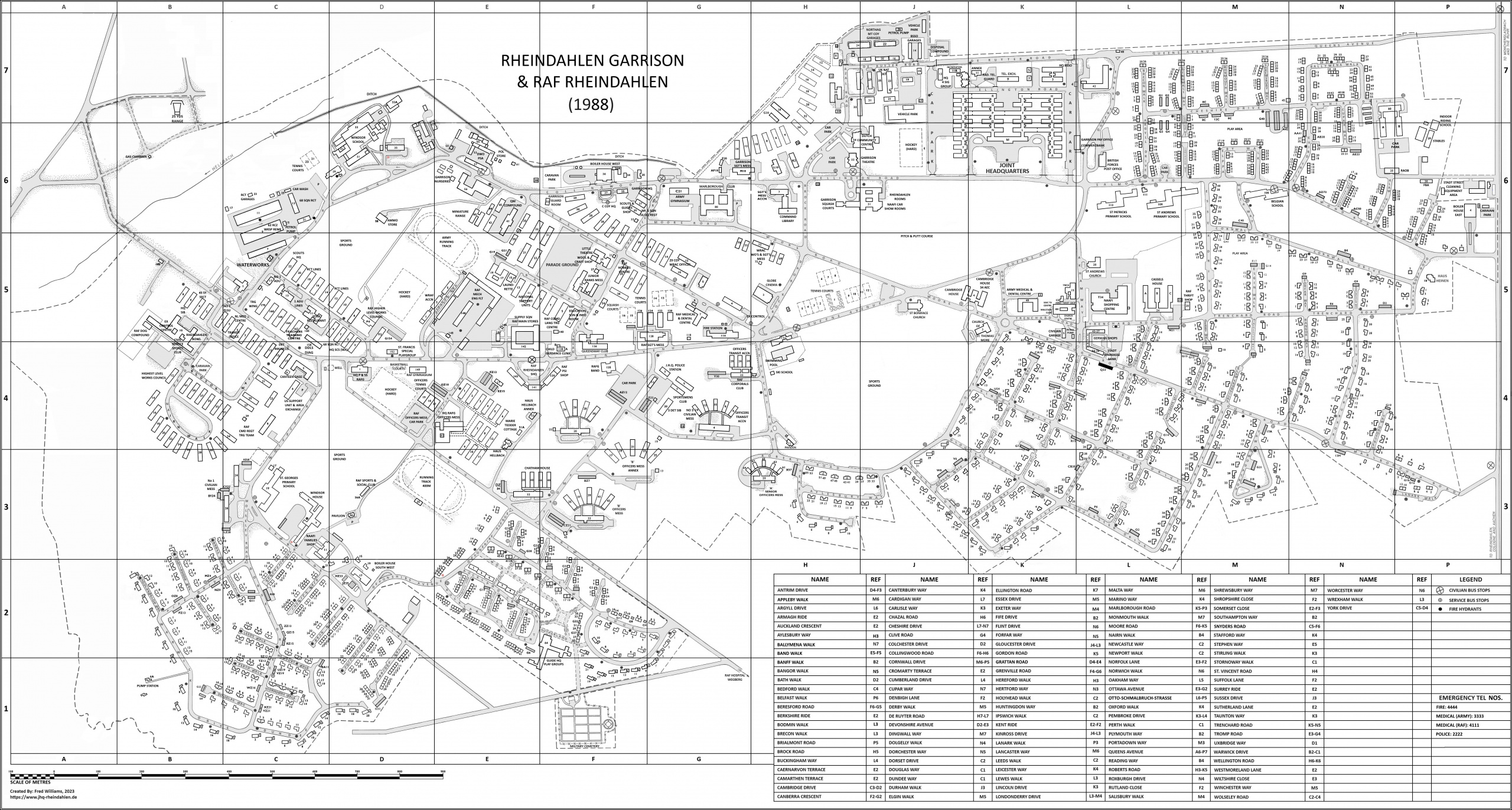
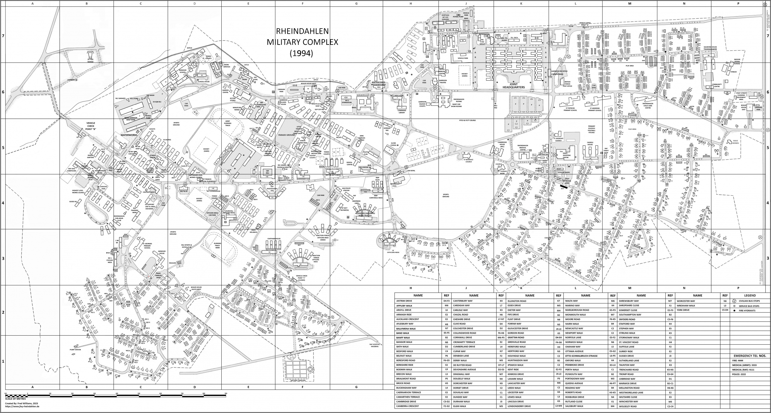
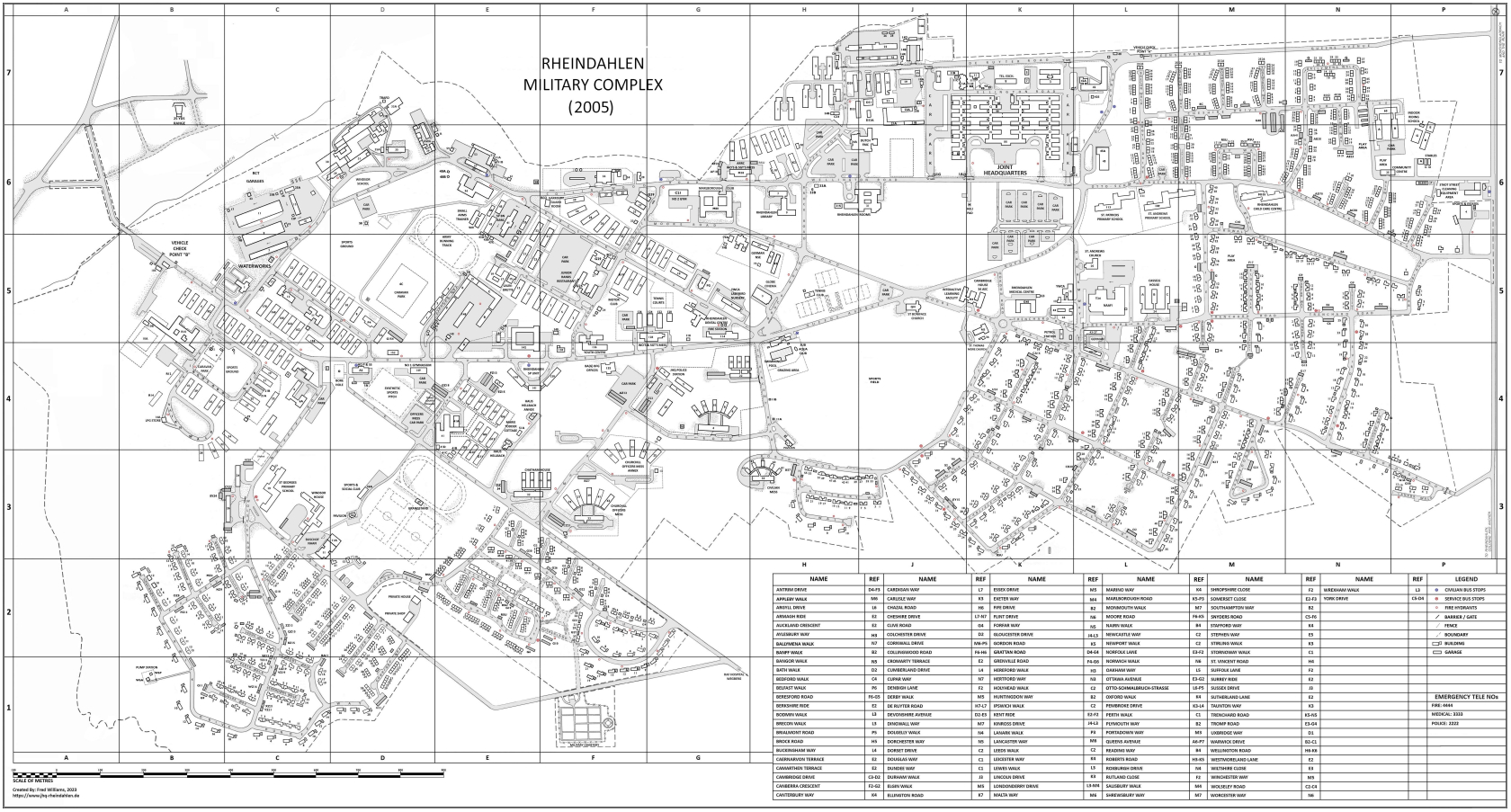
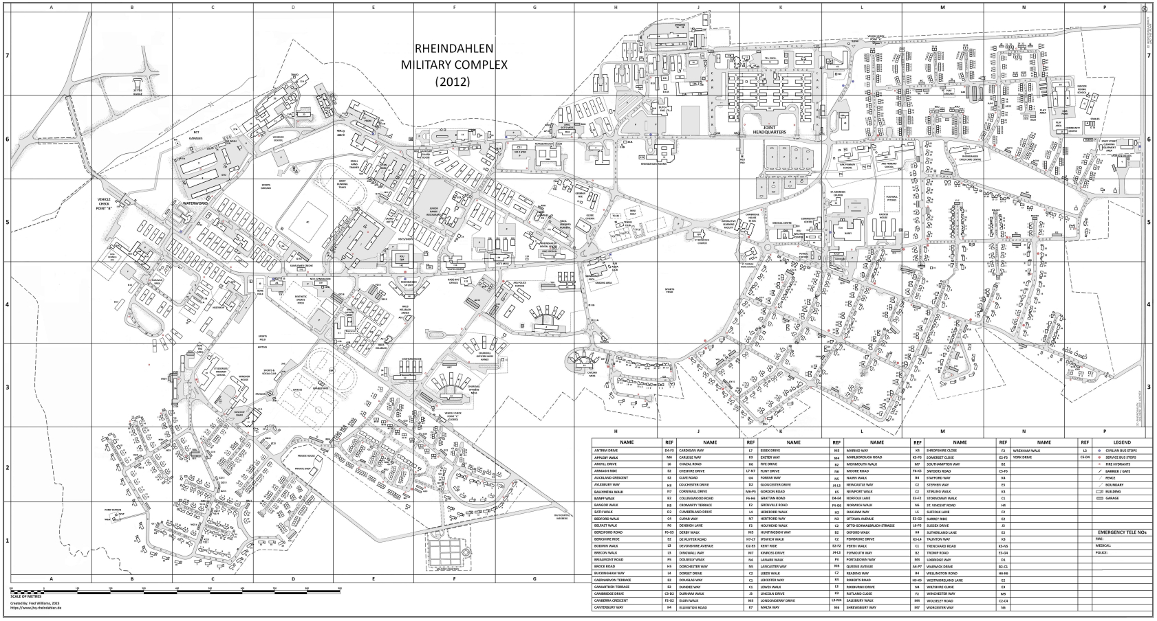
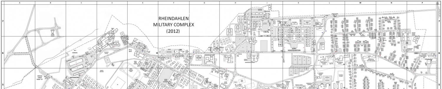
Maps
Have a look at the different maps of JHQ, in downloadable PDF format, that have been created by Fred Williams.
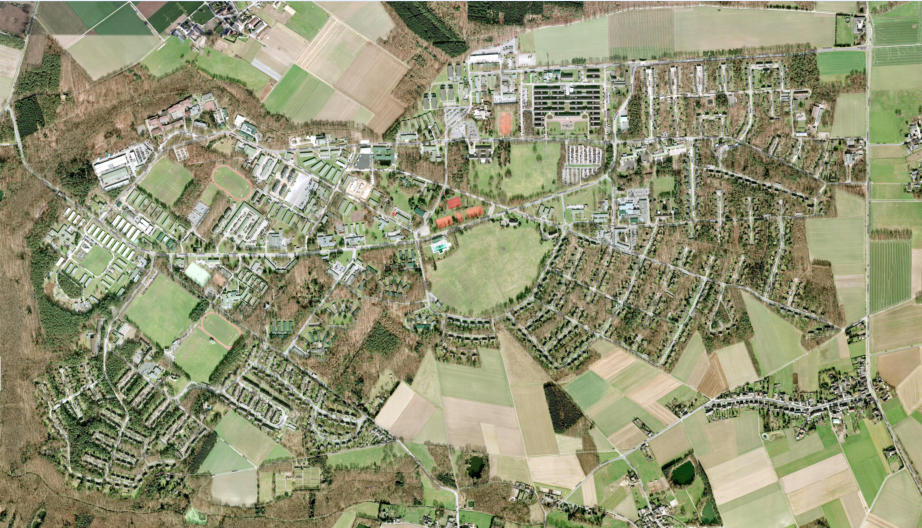
The “interactive” maps allow you to navigate around the current “Google” map of the JHQ area.
Of particular interest are the “buildings” which have been overlaid to show the location of houses that may no longer be visible on the latest “Google” map. Clicking on a building or road will display it’s name in a text bubble.
If you are registered you will be able to add your own location to the “Where did you live” and “Identify a Location/Building” interactive maps!
If anyone has other digital maps that may be of interest for placing on this website then please contact webmaster@jhq-rheindahlen.de
Click on the map below to see an example in a new tab: